
Groomed Cross-Country Ski Trails in the Boulder Junction Area
January 16, 2024
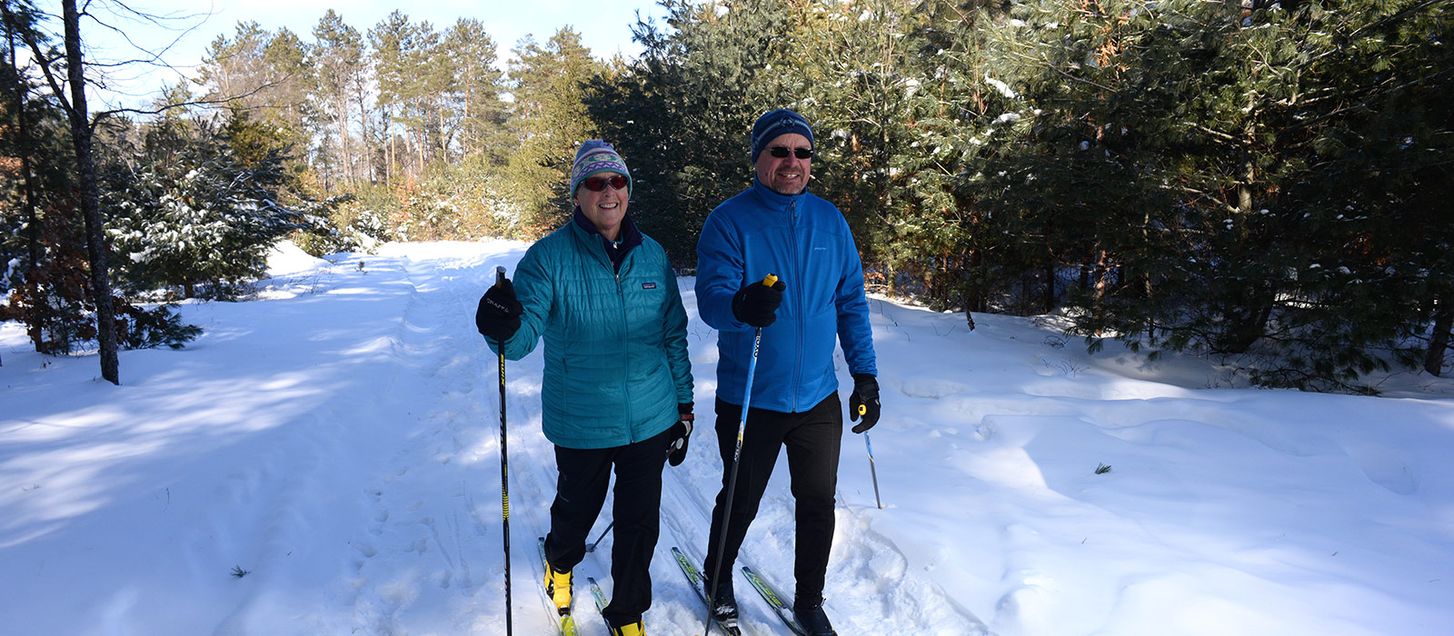
If you love to play in the snow, make tracks for Boulder Junction, one of the finest cross-country skiing destinations in the Northwoods of Wisconsin. The following is a list of groomed trails in the Boulder Junction area:
NORTH LAKELAND DISCOVERY CENTER TRAILS:
LENGTH: 12 miles GROOMED FOR: Classic
LOCATION: 15 miles west of Boulder Junction. Travel west on County Hwy K to the intersection of County Hwy W in Manitowish Waters, continue south on County Hwy W approximately 1.5 miles to the North Lakeland Discovery Center.
DESCRIPTION: Serene and secluded skiing trails around Statehouse Lake and along the Manitowish River. Easy/beginner and intermediate loops wind through new growth and old forest, and along bog and shoreline. Parking, trail info and warming house at the Discovery Center. No fee.
MAP OF TRAIL
NORTH LAKELAND SCHOOL NATURE & CROSS-COUNTRY SKI TRAIL SYSTEM:
LENGTH: 8-10 miles of looping trails GROOMED FOR: Classic
LOCATION: 10 miles west of Boulder Junction. Travel west on Hwy K. From the intersection of County Hwy K and Papoose Lake Road (west of the school), continue north on Papoose Lake Road approximately 1 mile to a parking area. Trailhead may be accessed from the north side of the school’s football field. No fee.
DESCRIPTION: These trails are located on the grounds of North Lakeland School and wind through a variety of towering evergreens and hardwoods. Overall easy level of difficulty with a few dips and small slopes. During the winter, the trails are groomed, as volunteers are available, by the North Lakeland/Northwoods Ski Touring Association.
MAP OF TRAIL
ESCANABA-PALLETTE LAKE TRAILS:
LENGTH: Loops of 2, 4, 5.5 and 8.5 miles GROOMED FOR: Classic
LOCATION: 7.5 miles south of Boulder Junction. Travel south on County Hwy M to Nebish Lake Road. Turn east on Nebish Lake Road and continue about 3.5 miles to the parking area on the north side of the road.
DESCRIPTION: This hilly, rolling and very scenic trail winds around several lakes and through a variety of timber types and has a shelter and fire ring provided. This intermediate level cross-country ski trail is tracked and a Wisconsin State Trail Pass is required. This trail connects to the Lumberjack Trail ( not groomed). *Pets are not allowed when there is snow.
MAP OF TRAIL
WINMAN TRAILS:
LENGTH: Trails vary by activity from 4.0 to 10 miles GROOMED FOR: Classic & Skate
LOCATION: 17 miles west of Boulder Junction. Travel west on Hwy K to the intersection of Hwy W. Head north on Hwy W (right). Trailhead and parking at the intersection of Hwy W and Hwy J (by the snowmobile trail).
DESCRIPTION: Located on more than 1,300 acres of private and public lands, this network of silent-sports trails offers opportunities for snowshoeing and classic- and skate-style cross-country skiing. No fee. Pets allowed on Snowshoe Trails.
MAP OF TRAIL
MADELINE LAKE TRAIL:
LENGTH: Various loops of 3.0, 3.5, 4.5 and 5.5 miles GROOMED FOR: Classic
LOCATION: 17 miles south of Boulder Junction. Take Hwy M south to Hwy 51. Continue south on Hwy 51 into Woodruff. Take Hwy 47 east, turn east on Hwy J. Turn north on Rudolph Road and watch for the parking area on the east side of the road.
DESCRIPTION: Madeline Lake Trail offers a variety of beautiful scenery winding around three lakes. A shelter with a fire ring is provided. This designated tracked cross-country ski trail requires a Wisconsin State Trail Pass. *Pets are not allowed when there is snow or on groomed trails.
MAP OF TRAIL
RAVEN TRAIL:
LENGTH:Loops of 1.5, 2.5, 3.5 and 5 miles GROOMED FOR: Classic
LOCATION: 20 miles south of Boulder Junction. Take Hwy M south to Hwy 51. Continue south on Hwy 51 into Woodruff. Take Hwy 47 East. From the intersection of County Hwy J and Hwy 47, continue south on Hwy 47 about 3 miles. Turn north (left) on Woodruff Road and continue to the Raven Trail sign approximately .5 miles.
DESCRIPTION: A mix of intermediate and expert loops wind through woods and near Inkpot and Clear Lakes. The tracked cross-country ski trails require Wisconsin State Trail Passes. *Pets are not allowed when there is snow or on groomed trails.
MAP OF TRAIL
RAZORBACK RIDGES TRAILS:
LENGTH: 16 miles GROOMED FOR: Classic & Skate
LOCATION: 12 miles south of Boulder Junction. Take Hwy M south to the intersection of Hwy N. Turn east (left) on Hwy N. At the intersection of Hwy 155 and County Hwy N in Sayner, continue west on County Hwy N about 2 miles to Razorback Road. Turn north on Razorback Road and a parking area.
DESCRIPTION: Scenic trails featuring a variety of trail loops for beginner to expert cross-country skiers and snowshoeing in the winter. This is a community project of the Sayner-Star Lake Lions in cooperation with the Wisconsin DNR. No fee.*Pets are not allowed when there is snow.
MAP OF TRAIL
MCNAUGHTON TRAIL:
LENGTH: 13 miles GROOMED FOR: Classic & Skate
LOCATION: 28 miles south of Boulder Junction. Take Hwy M south to Hwy 51. Continue south on Hwy 51 into Woodruff. Take Hwy 47 East. Continue on Hwy 47. Three miles north of Town of McNaughton on Hwy 47, then west on Killdare Rd.
DESCRIPTION: Gentle terrain with very few steep hills. Cross country skiing on entire trail, no hiking or biking in winter. Separate skating and diagonal ski trails. The tracked cross-country ski trails require Wisconsin State Trail Passes. *Pets are not allowed when there is snow or on groomed trails.
MAP OF TRAIL
Download the Map It Vilas County trails app to see trail info for the entire county.
Find the latest cross-country ski trail reports here. Check out our webcam to see the conditions for yourself.
Looking for ski rentals? You’ll find skis for rent at Coontail in downtown Boulder Junction.