
Heart of Vilas County: Bike Over 50 Miles of Paved Trail
July 8, 2024
The Heart of Vilas County Paved Bike Trail System was named a National Recreation Trail in 2020, an honor the Department of the Interior gives to exemplary trails of local and regional significance. Winding through some of the best natural beauty and local history in the Northwoods, trail advocates say the national recognition is well-deserved.
“People are coming here specifically to ride this trail,” said Theresa Smith, past executive director of the Boulder Junction Chamber of Commerce. “They are interested in being outside, staying active and seeing all the beauty that we have in Vilas County and beyond.”
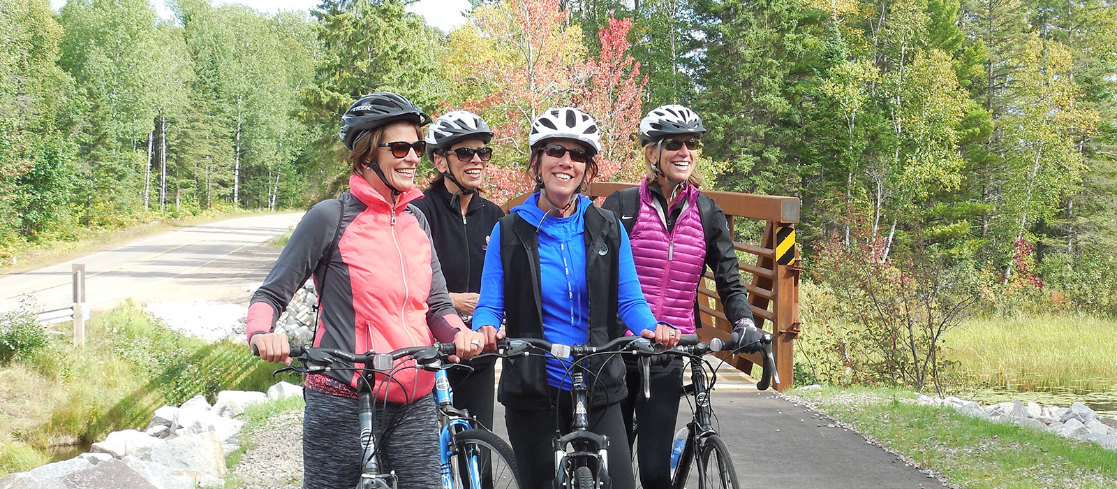
The Heart of Vilas County Paved Bike Trail System is a scenic 52-mile paved trail that connects the communities of St. Germain, Sayner, Boulder Junction and Manitowish Waters in Vilas County and Mercer in Iron County.
The smooth asphalt trail travels through Wisconsin’s largest state forest—the 223,000-acre Northern Highland-American Legion State Forest—giving riders a wilderness experience while offering amenities that make the journey as easy as it is rewarding.
Cherie Sanderson, past President of the Boulder Junction Chamber of Commerce and Director of the Boulder Junction Library, said that one of the things that makes the trail special is the varied landscape it crosses, including wild forests, wetlands, prairie areas and undeveloped glacial lakes.
Sanderson is a cyclist who has logged a lot of miles on the system on her hybrid bike.
“It’s simply a beautiful ride,” she said. “Every part of it offers something new and beautiful that you would not see if you were riding on the road.”
The trail takes riders through various terrain, from flat-to-rolling land, manageable hills, and multiple scenic bridges. The segments between towns form a complete route that involves little road riding. While some cyclists opt to ride the entire route point-to-point, many choose to pick a shorter segment to ride. There are 20 parking areas along the trail, so it’s easy to break the trail into a series of rides. Several restrooms and bicycle fixations are available to trail users.
While the trail rolls through some incredible Northwoods scenery, its connection to the communities of northern Wisconsin is also part of the trail’s charm.
There is no fee or trail pass required.
Length: 52 miles
Location: There are many parking areas along the trail. A prime parking location in Boulder Junction is at the Sports and Recreation Park next to the Chamber office on County Hwy M. Please refer to the map for additional parking areas.
View Map or request one to be mailed to you.
Specific mileage for segments of the trail is as follows:
Boulder Junction to Nichols Lake Road: 2.2 miles, flat terrain
Boulder Junction to Manitowish Waters: 15.8 miles, flat terrain with several bridges crossing wetlands
Boulder Junction to Manitowish Waters Chamber: 17 miles, flat terrain crossing Hwy 51
Boulder Junction to Mercer: 24 miles, continues from Manitowish Waters to Mercer on paved trails and lightly used roads
Boulder Junction North on Hwy M to Dairyman’s Road: 2.5 miles, flat terrain
Boulder Junction to North Trout Lake: 3.1 miles, rolling terrain with some steep hills
Boulder Junction to Cathedral Point Lane: 5 miles, rolling terrain with some steep hills
Boulder Junction to Hwy N: 9 miles, rolling terrain with some steep hills
Hwy N to Crystal Lake Campground: 2.2 miles, flat terrain
Crystal Lake Campground to Sayner: 4 miles, flat to rolling terrain
Sayner to St. Germain Chamber: 8.5 miles, rolling terrain with some steep hills
St. Germain Chamber to Hwy O: 5.5 miles, flat terrain